Precision Aerial Imaging and Geospatial Data Solutions
Achieving successful aerial acquisition throughout Nebraska demands meticulous mission planning, seamless sensor integration, and navigating complex regulatory approvals. Helicopters Over Lincoln serves as your trusted mission partner, managing every critical detail. We thoroughly assess your specific data or footage requirements for projects in Lincoln, Omaha, or regional areas, then expertly align the ideal helicopter and flight profile. We handle all intricate flight planning, necessary permits, and operational logistics. The result is a single point of accountability and a turnkey solution that delivers your precise aerial data or imagery.
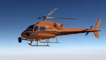
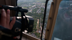
Cinema & Broadcast Videography
For feature films, commercials, and live broadcast events across Nebraska, we provide the exceptionally stable, high-performance helicopter platforms demanded by Directors of Photography. Our specialized operations support industry-standard stabilization systems, including Shotover, Cineflex, and Tyler Mounts. We coordinate seamlessly with your production crew, ensuring precise flight paths and flawless execution for every critical shot, whether filming in downtown Lincoln or rural landscapes.
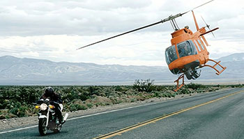
Aerial Photography
Elevate your visual storytelling with high-resolution aerial photography for marketing, real estate portfolios, and project progress documentation across Lincoln. Our operators master lighting, angles, and composition, delivering impactful, magazine-quality stills that capture attention and convey professionalism.
LiDAR & Geospatial Surveying
We provide actionable data beyond visual limitations. Our services include LiDAR acquisitions, orthomosaic mapping, and 3D terrain modeling. These are crucial for precise urban planning, utility inspections across Lancaster County, and critical environmental monitoring.
Utility & Asset Inspection
We conduct rapid, detailed inspections of transmission lines, pipelines, and cell towers. Our helicopters offer the stable hover and precise flight control necessary for high-fidelity asset auditing throughout the Lincoln area and beyond.
Technical FAQ
Our platforms are configured for major industry mounts, including Shotover (F1, K1), Cineflex, and Wescam. For lighter cinema payloads, we also support Tyler Minigyro and Middle mounts. We ensure compatibility for every aerial production in Nebraska.
Yes. We manage all required airspace authorizations and flight plans for urban operations, including those within Lincoln's controlled airspace. Our flight operations team is experienced in navigating complex environments, ensuring your aerial photography is captured legally and safely.
We offer a comprehensive solution; we can provide the sensor operator, or fly your creative team. If you bring your own crew for aerial photography around Lincoln, we conduct thorough briefings on safety and critical air-to-ground coordination protocols.
Depending on your sensor payload, we deliver raw point clouds (LAS/LAZ), orthomosaic maps (TIFF/ECW), or processed 3D meshes. We collaborate with your GIS team to guarantee seamless file compatibility for your projects in Nebraska.
Gallery
Aerial Photography
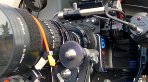
Camera Equipment
Camera Mounts

Damage Survey

Real Estate Survey
Aerial Videography
Your Complete Aerial Photography and Videography Solutions in Lincoln
Contact Helicopters Over Lincoln at 1-855-445-8965 today. Get a fast, no-obligation quote for premier helicopter aerial photography services across the region.